
Table of Contents
ToggleKilimanjaro Rongai Route
Geography, geology & ecosystem science of the rongai
Kilimanjaro Northern Corridor Environmental System
The Kilimanjaro Rongai Route represents one of the most geologically and ecologically distinct ascent corridors on the entire structure of the Mount Kilimanjaro. Unlike the southern approaches that are heavily influenced by Indian Ocean moisture systems and dense human-access trekking infrastructure, the northern face of Kilimanjaro exists within a fundamentally different environmental regime shaped by rain shadow physics, tectonic uplift patterns, and long-term volcanic erosion dynamics.
From a geological standpoint, Mount Kilimanjaro is a stratovolcano formed through successive layers of lava deposition, ash accumulation, and eruptive collapse events spanning hundreds of thousands of years. The Rongai Route interacts with the mountain at a unique angle—approaching from the relatively dry northern flank where volcanic deposits are more exposed and less eroded by precipitation. This creates a terrain profile that is structurally more stable in certain sections, but also more arid, with thinner organic soil development in comparison to the southern rainforest belt.
One of the most defining physical characteristics of the Rongai approach is its relationship to orographic rainfall distribution. As moist air masses travel inland from the Indian Ocean, they are forced upward by Kilimanjaro’s southern slopes. This upward movement causes cooling and condensation, releasing most precipitation on the southern and southeastern sides of the mountain. By the time these air masses descend toward the northern side, they have lost a significant portion of their moisture content. This creates what is known as a rain shadow environment, which directly shapes everything from vegetation density to soil composition and trail stability.
Because of this climatic asymmetry, the Rongai Route exhibits a markedly different ecological structure compared to other Kilimanjaro routes. Instead of transitioning rapidly from rainforest into wet moorland ecosystems, the northern corridor begins with relatively dry savannah and cultivated farmland zones. These low-altitude regions are influenced more by regional East African semi-arid climate systems than by direct mountain rainfall dynamics.
As climbers ascend from the base region, the first major ecological transformation occurs at the boundary between human-influenced agricultural zones and natural montane forest systems. This transition is not abrupt but gradual, marked by increasing tree density, shifts in canopy structure, and changes in humidity retention within the microclimate. The montane forest on the Rongai side tends to be less dense and less humid than its southern counterpart, yet still supports a rich biodiversity adapted to cooler and moderately moist conditions.
The geological substrate in this region is largely composed of volcanic ash layers interspersed with basaltic rock formations. These layers influence drainage patterns significantly, resulting in relatively well-drained soils that reduce surface water accumulation. This contributes to the generally dry trekking conditions for which the Rongai Route is known, even during seasonal rainfall periods.
As elevation increases further, the forest begins to thin and transitions into heather and moorland ecosystems, which represent a key ecological midpoint in Kilimanjaro’s vertical zoning system. These ecosystems are characterized by hardy, low-growing vegetation such as giant lobelias, senecio plants, and specialized alpine shrubs adapted to high ultraviolet exposure and low atmospheric pressure conditions. The presence of these plant species is a direct biological response to the mountain’s equatorial high-altitude environment, where daily temperature fluctuations can be extreme, often ranging from warm daytime sunlight to near-freezing nighttime conditions.
This moorland zone is particularly significant in the Rongai Route because it reflects the beginning of true alpine adaptation conditions. Oxygen concentration begins to decline more noticeably, atmospheric pressure drops, and the human body starts to experience measurable physiological stress responses. While not yet in the extreme environment of the summit zone, this region acts as a critical biological transition layer where acclimatization processes begin to intensify.
One of the most important geological features encountered beyond the moorland zone is the formation known as the Saddle, a vast high-altitude plateau situated between the volcanic cones of Mawenzi and Kibo. This area is composed primarily of volcanic ash deposits, pumice fragments, and weathered lava fields that have been shaped by centuries of freeze-thaw cycles and wind erosion.
The Saddle represents a unique geomorphological system within Kilimanjaro’s structure. It is one of the largest unbroken high-altitude desert plains in the region, characterized by minimal vegetation, extreme exposure to wind, and high diurnal temperature variation. During daylight hours, solar radiation intensity is amplified due to thin atmospheric filtering, while nighttime conditions can drop rapidly into sub-zero temperatures due to radiative heat loss.
From a scientific perspective, this zone is critical because it represents the point at which biological systems begin to struggle significantly with oxygen scarcity. Plant life becomes almost nonexistent here, limited to microscopic lichens or highly specialized extremophiles. For climbers, this translates into a stark environmental shift where energy expenditure increases while physiological efficiency decreases.
The northern approach through Rongai therefore offers a highly structured environmental progression that can be understood as a vertical ecosystem ladder. Each ecological band is not random but directly tied to measurable changes in altitude, atmospheric pressure, and temperature gradients. This makes the Rongai Route particularly valuable for understanding how human physiology interacts with stratified mountain environments in real time.
Geography, geology & ecosystem science of the rongai route (part 2)
Biome Transition System & Volcanic Landscape Architecture of Northern Kilimanjaro
Building on the northern corridor framework of the Rongai approach to the Mount Kilimanjaro, the second phase of understanding this route requires a deeper examination of how ecological zones transition vertically across the mountain’s structure. Unlike horizontal landscapes where ecosystems shift gradually across distance, Kilimanjaro’s environments change primarily through altitude-driven stratification, meaning that vertical gain replaces lateral movement as the dominant driver of ecological transformation.
On the Rongai Route, this transition is especially clean and scientifically legible due to reduced rainfall interference and lower vegetation density compared to the southern slopes. This clarity allows the mountain to function almost like a natural ecological cross-section, where each altitude band represents a distinct biome with measurable physical and biological boundaries.
1. Forest–Moorland Transition: The First Major Ecological Threshold
The first significant biome shift occurs as climbers exit the montane forest zone and enter the heather and moorland belt. This transition is not abrupt but is marked by a gradual reduction in canopy density, increased sunlight penetration, and a noticeable shift in soil composition.
From a botanical perspective, the montane forest is dominated by taller, moisture-dependent tree species whose survival relies on consistent atmospheric humidity and relatively stable temperature ranges. As elevation increases, these conditions begin to deteriorate. Reduced air pressure leads to lower moisture retention in vegetation, while increased solar exposure intensifies evapotranspiration stress on plant systems.
This environmental pressure causes a systematic thinning of forest structure. Large canopy trees give way to smaller, more resilient vegetation adapted to intermittent moisture and higher UV exposure. This is where species such as giant heathers and early alpine shrubs begin to dominate the ecological profile.
In geological terms, the underlying volcanic soils in this transition zone play a critical role. These soils are primarily composed of weathered ash deposits mixed with basalt fragments, which provide moderate drainage but limited nutrient retention. This restricts dense forest regeneration and encourages more specialized, drought-resistant plant communities.
The Rongai Route’s northern positioning amplifies this transition effect. Because precipitation levels are lower, soil moisture decreases more rapidly with elevation, accelerating the shift from dense forest to open moorland compared to southern approaches.
2. Moorland Ecosystem: High-Altitude Adaptation Zone
The moorland belt represents one of the most biologically distinctive regions of Kilimanjaro. It exists roughly between 2,800 meters and 4,000 meters, depending on local microclimatic conditions. In this zone, vegetation is dominated by highly specialized alpine flora adapted to extreme diurnal temperature variation.
One of the most characteristic species in this environment is the giant lobelia, a plant that exhibits unique water storage and thermal regulation mechanisms. These plants have evolved to survive in conditions where daytime temperatures can be relatively mild under direct sunlight, but nighttime temperatures drop sharply due to radiative cooling in thin atmospheric conditions.
Another dominant feature of this zone is the presence of Senecio kilimanjari, a plant species specifically adapted to high-altitude UV exposure. These plants often develop insulating dead leaf layers around their stems, functioning as a natural thermal buffer against freezing nighttime conditions.
From a geomorphological perspective, the moorland zone is also defined by increased surface exposure of volcanic rock formations. Erosion processes in this region are primarily driven by freeze-thaw cycles rather than liquid water flow. As temperatures fluctuate above and below freezing, water trapped in rock fissures expands and contracts, gradually breaking down basalt structures into coarse volcanic gravel.
This process contributes to the formation of unstable but visually striking terrain characterized by rocky outcrops, scattered vegetation patches, and broad open visibility across the mountain’s slopes.
For climbers, this zone represents the first real introduction to sustained altitude stress. Oxygen levels begin to decline more noticeably, and the human body starts transitioning from sea-level metabolic efficiency to high-altitude adaptive functioning.
3. Alpine Desert Formation: The Kibo–Mawenzi Interface System
Above the moorland zone, the landscape transitions into one of the most extreme terrestrial environments on Earth: the alpine desert system. This region is not defined by a single ecosystem but rather by a convergence of multiple limiting factors, including low atmospheric pressure, extreme temperature variation, high UV radiation, and minimal soil development.
The Rongai Route enters this system through the expansive geological corridor known as the Saddle, positioned between the two major volcanic structures of Kilimanjaro: Mawenzi and Kibo.
Geologically, this area is composed of ancient lava flows, pyroclastic deposits, and volcanic ash layers that have been extensively reworked by wind erosion and thermal cycling over thousands of years. Unlike lower zones where soil formation is biologically active, the Saddle region exhibits extremely slow pedogenic processes due to the absence of organic input and limited moisture availability.
The surface structure is largely barren, consisting of fragmented volcanic rock, ash plains, and compacted tephra fields. These materials have low cohesion and high thermal responsiveness, meaning surface temperatures can fluctuate dramatically within a single 24-hour cycle.
During daylight hours, intense solar radiation penetrates the thin atmosphere, causing surface heating that can create deceptively warm conditions. However, once the sun sets, rapid radiative cooling causes temperatures to plummet, often reaching well below freezing.
This extreme thermal oscillation creates a biome that is hostile to most biological life. Vegetation is virtually absent, and only the most extremophile organisms—such as certain lichens and microbial colonies—are capable of surviving in isolated microhabitats.
4.The Saddle System: Structural Geology of Mawenzi–Kibo Corridor
The Saddle is not merely a flat transitional zone; it is a structurally significant geological feature formed by long-term volcanic interaction between Kilimanjaro’s twin peaks.
Mawenzi, located to the east, is a heavily eroded volcanic cone characterized by sharp ridges and exposed basalt spires. Its current structure is the result of extensive erosion over geological time scales, leaving behind a jagged and highly fragmented mountain profile.
Kibo, on the western side, represents the main volcanic mass of Kilimanjaro and contains the dormant summit crater leading to Uhuru Peak. Its structure is smoother and more massive, reflecting different phases of volcanic activity and lava deposition.
Between these two formations lies the Saddle basin, which acts as a geological buffer zone. This basin was formed through combined processes of volcanic deposition, structural collapse, and long-term erosion. It now functions as a high-altitude plateau that connects both peaks while also separating their distinct geological identities.
From a structural geology perspective, the Saddle is significant because it reveals the internal architecture of Kilimanjaro’s volcanic system. It demonstrates how multiple eruptive phases contributed to the mountain’s current shape and how erosion selectively removed weaker materials while leaving more resistant basalt formations intact.
5. Microclimate Variability Across Rongai’s Vertical Gradient
One of the most scientifically important aspects of the Rongai Route is its clear expression of microclimate variation across altitude bands. Because the northern slope experiences reduced precipitation interference, atmospheric behavior is more directly linked to elevation rather than localized weather disturbances.
This creates a predictable microclimate sequence:
- Low Altitude (Savannah Zone): warm, semi-arid conditions with seasonal variability
- Montane Forest: moderate humidity, stable temperatures, localized fog formation
- Moorland Zone: high diurnal temperature variation, increased UV exposure
- Alpine Desert: extreme temperature swings, low humidity, high wind exposure
- Summit Zone: arctic conditions with near-permanent freezing temperatures
Each of these zones behaves as an independent climate system, yet they are vertically stacked within a single mountain structure. This makes Kilimanjaro one of the most efficient natural models for studying altitude-driven climate transitions.
The Rongai Route, due to its clarity and reduced environmental noise from rainfall systems, offers one of the most interpretable versions of this vertical climate model.
Volcanic Evolution, Crater Architecture & Cryospheric Systems of Kilimanjaro
The northern approach of the Rongai Route on the Mount Kilimanjaro does not only traverse ecological zones—it passes through the exposed geological memory of one of Africa’s most complex volcanic systems. To fully understand this route, it is necessary to examine Kilimanjaro not as a mountain in a static sense, but as a multi-phase volcanic structure shaped by long-term eruptive, erosional, and climatic processes.
1. Volcanic Origin and Stratovolcanic Construction of Kilimanjaro
Mount Kilimanjaro is classified as a stratovolcano, meaning it was formed through successive layers of lava flows, ash deposits, and pyroclastic material accumulated over hundreds of thousands of years. Unlike single-event volcanic formations, stratovolcanoes grow through repeated eruptive cycles, each contributing a distinct geological layer to the mountain’s structure.
Kilimanjaro’s formation began with early volcanic activity along the East African Rift System, where tectonic divergence created pathways for magma to rise from deep within the Earth’s mantle. Over time, multiple volcanic centers emerged, eventually coalescing into the three major volcanic cones that define the mountain today:
- Kibo (central, highest, and currently dormant summit cone)
- Mawenzi (east, heavily eroded and geologically older)
- Shira (west, collapsed and largely eroded plateau system)
The Rongai Route primarily interacts with the Kibo volcanic system, but its northern approach provides indirect exposure to the structural relationship between these three cones.
2. Kibo Crater System: The Summit Architecture
At the core of Kilimanjaro lies the Kibo volcanic cone, which contains the summit region culminating in Uhuru Peak, the highest point in Africa. The summit area is not a single peak in the traditional sense but rather the rim of a large, partially collapsed volcanic crater.
This crater system consists of several key structural components:
Reusch Crater
The inner crater is a relatively symmetrical depression formed during the final phases of volcanic activity. It contains layers of ash, hardened lava, and volcanic debris that reflect past eruptive events.
Ash Pit and Fumarolic Zones
Within the crater interior are geothermal features such as fumaroles—vents that release volcanic gases. Although Kilimanjaro is considered dormant rather than active, these gas emissions indicate residual geothermal heat beneath the surface.
Crater Rim and Summit Points
The outer crater rim includes several named high points, with Uhuru Peak positioned along the southwestern rim. This structure is the result of erosion and partial collapse of the original volcanic cone, reshaping the summit into a broad circular system rather than a single volcanic spike.
From a geological perspective, the Kibo crater represents a late-stage stratovolcanic evolution phase, where eruptive activity has ceased but internal geothermal processes remain partially active.
3. Mawenzi and Structural Erosion Dynamics
To the east of Kibo lies Mawenzi, a sharply eroded volcanic cone that provides critical insight into long-term mountain degradation processes.
Unlike Kibo, Mawenzi has experienced extensive erosion due to:
- prolonged exposure to wind and temperature cycles
- reduced volcanic resurfacing activity
- freeze-thaw rock breakdown at high altitude
- gravitational collapse along steep structural ridges
As a result, Mawenzi today appears as a jagged, spire-like formation composed of exposed basalt intrusions and fragmented volcanic layers.
From the Rongai Route perspective, Mawenzi plays an important visual and geological role. It defines one side of the Saddle basin and acts as a natural geological reference point for understanding the asymmetry of Kilimanjaro’s volcanic system.
4. Shira Plateau Collapse System and Ancient Volcanic History
To the west of Kilimanjaro lies the remnants of the Shira volcano, one of the earliest volcanic structures in the region. Unlike Kibo and Mawenzi, Shira is largely collapsed, forming a high-altitude plateau rather than a conical peak.
This collapse is believed to have occurred when structural instability and erosion caused the volcanic chamber to subside, leaving behind a broad elevated platform.
The Shira Plateau is particularly significant because it represents:
- an ancient volcanic foundation layer of Kilimanjaro
- a transitional geological stage between active and extinct volcanic systems
- a high-altitude ecosystem formed on ancient lava deposits
Although the Rongai Route does not directly traverse Shira in the same way as western routes, its geological influence is still relevant in understanding Kilimanjaro’s full volcanic history.
5. Cryospheric System: Glaciers and Ice Cap Dynamics
One of the most scientifically significant and rapidly changing components of Kilimanjaro is its cryospheric system, which includes glaciers, ice fields, and permanent snow cover near the summit region.
Historically, Kilimanjaro was known for its extensive ice cap, which covered large portions of the summit plateau. However, modern climatic changes have led to a dramatic reduction in glacial coverage over the past century.
The remaining glaciers are primarily located:
- on sheltered sections of the crater rim
- in shaded ice fields protected from direct solar exposure
- in residual ice formations that persist due to localized microclimates
These glaciers are not static structures. They are continuously influenced by:
- solar radiation intensity near the equator
- atmospheric humidity fluctuations
- sublimation (direct ice-to-vapor transition)
- reduced snowfall replenishment
Unlike polar ice systems, Kilimanjaro’s glaciers exist in a high-altitude tropical environment, making them extremely sensitive to small climatic shifts.
6. Summit Zone Thermal Dynamics and Atmospheric Physics
At elevations near 5,000–5,895 meters, the Rongai Route enters one of the most extreme atmospheric environments on Earth. The summit zone is characterized by:
- extremely low atmospheric pressure
- reduced oxygen concentration (~50% of sea-level availability)
- high ultraviolet radiation exposure
- minimal atmospheric moisture
- rapid temperature fluctuations
During daytime, solar radiation can still produce surface warming, but due to thin atmospheric density, heat retention is extremely limited. At night, radiative heat loss is rapid, causing temperatures to drop sharply.
Wind patterns also play a critical role in shaping summit conditions. Strong upper-atmosphere winds accelerate heat loss through convection, increasing the perceived cold intensity (wind chill effect).
This combination of factors creates a cryogenic alpine environment, where biological activity is nearly nonexistent and physical endurance becomes the primary limiting factor for human movement.
7. Long-Term Climate Evolution of Kilimanjaro
The geological and climatic history of Kilimanjaro is closely linked to broader East African climate shifts. Over thousands of years, the mountain has experienced cycles of:
- glacial expansion during cooler climatic periods
- glacial retreat during warmer interglacial phases
- vegetation migration up and down elevation bands
- shifting precipitation patterns influenced by regional atmospheric systems
The current phase is characterized by accelerated glacial retreat, driven by both natural variability and long-term atmospheric warming trends. This has resulted in a visible reduction of summit ice fields and changes in high-altitude hydrological balance.
From a scientific perspective, Kilimanjaro serves as a natural indicator system for studying tropical glacier sensitivity to climate change.
Microclimate Systems, Atmospheric Circulation, Soil Formation & Hydrology of the Northern Kilimanjaro Slope
The Rongai Route on the Mount Kilimanjaro provides one of the clearest natural laboratories for studying how microclimate systems, soil evolution, and mountain hydrology interact in a high-altitude equatorial environment. Unlike more humid southern approaches, the northern slope operates under a distinct climatic regime shaped by rain shadow effects, reduced moisture transport, and simplified atmospheric turbulence patterns.
This part of Volume 1 focuses on how air movement, soil development, and water systems behave along the Rongai corridor and how these processes define both the trekking environment and long-term landscape stability.
1. Vertical Microclimate Zonation Along the Rongai Route
The Rongai Route demonstrates a highly structured vertical climate gradient, where environmental conditions change predictably with elevation rather than horizontal distance. This is a direct result of Kilimanjaro’s massive vertical relief, which rises from approximately 800–900 meters at the base to 5,895 meters at the summit.
This creates a stacked system of microclimates:
Lowland Savannah Microclimate (800–1,800m)
At the base of the Rongai Route, the climate is semi-arid to dry savannah. Temperatures are generally warm during the day and mild at night. Rainfall is seasonal and relatively low compared to southern slopes.
Key characteristics:
- high solar radiation exposure
- intermittent rainfall patterns
- open grassland and agricultural influence
- strong diurnal temperature variation
This zone is influenced more by regional East African climate systems than by direct mountain-driven weather.
Montane Forest Microclimate (1,800–2,800m)
As elevation increases, humidity levels rise slightly due to orographic uplift, but overall moisture remains lower than southern Kilimanjaro forests.
This zone is characterized by:
- cooler temperatures
- increased cloud formation at mid-elevations
- localized fog development
- stable but low-intensity rainfall events
The forest acts as a biological humidity buffer, capturing moisture from passing air masses and recycling it through evapotranspiration cycles.
Heather and Moorland Microclimate (2,800–4,000m)
This zone experiences one of the most dynamic microclimate shifts on the mountain.
Key environmental traits include:
- high solar radiation during the day
- rapid nighttime cooling
- low atmospheric humidity
- frequent wind exposure
The absence of dense tree cover means that heat retention is minimal. As a result, ground temperatures fluctuate dramatically, creating a stressful environment for both vegetation and climbers.
Alpine Desert Microclimate (4,000–5,000m)
The alpine desert zone is defined by extreme environmental instability.
Conditions include:
- very thin atmospheric pressure
- minimal moisture availability
- intense UV exposure
- high wind variability
- strong thermal contrast between day and night
This is one of the most physiologically demanding environments on the route, where human adaptation becomes the dominant survival factor rather than ecological comfort.
Summit (Arctic) Microclimate (5,000–5,895m)
At the summit zone, conditions resemble polar desert environments despite being located near the equator.
Key features:
- sub-zero temperatures year-round
- extremely low oxygen availability
- permanent or semi-permanent ice presence
- strong katabatic wind flows (downslope cold air movement)
This zone is governed more by altitude physics than by regional climate systems, making it one of the most extreme trekking environments globally.
2. Atmospheric Circulation and Wind Systems on Northern Kilimanjaro
The northern slope of Kilimanjaro is influenced by complex atmospheric circulation patterns shaped by equatorial positioning and large-scale East African weather systems.
Unlike mid-latitude mountains, Kilimanjaro experiences:
- weak seasonal temperature variation
- strong daily thermal cycling
- alternating air mass dominance (continental vs. maritime influence)
Orographic Wind Behavior
As air masses approach Kilimanjaro, they are forced upward by the mountain’s mass. On the southern side, this produces heavy rainfall. On the northern side, however, descending air becomes drier and warmer due to compression.
This results in:
- reduced precipitation on Rongai
- clearer skies on the northern slope
- stronger evaporation rates at lower elevations
Diurnal Wind Cycles
Wind patterns are strongly influenced by daily heating and cooling cycles:
- daytime: upslope winds as air warms and rises
- nighttime: downslope winds as cold air descends
This creates a predictable daily rhythm that directly impacts trekking conditions, especially in exposed alpine zones.
Summit-Level Jet Stream Interaction
At higher elevations, Kilimanjaro is occasionally influenced by upper-atmosphere wind currents. These winds can:
- increase perceived cold through wind chill
- accelerate moisture loss from exposed surfaces
- contribute to rapid weather changes during summit attempts
3. Soil Formation Processes Across the Rongai Gradient
Soil development on Kilimanjaro is directly controlled by volcanic origin, climate variability, and biological activity. Along the Rongai Route, soil systems transition from biologically active layers to nearly inert mineral surfaces.
Volcanic Parent Material Foundation
All soils on Kilimanjaro originate from volcanic materials including:
- basaltic lava flows
- ash deposits (tephra)
- pumice fragments
- weathered volcanic rock
These materials provide the base structure for all soil evolution on the mountain.
Forest Zone Soils (Andosol Development)
In the montane forest zone, soils are relatively mature and biologically active. These soils are classified as andosols, formed from volcanic ash interacting with organic matter.
Characteristics include:
- high organic content
- good water retention
- moderate fertility
- active microbial ecosystems
This supports dense vegetation growth despite relatively shallow soil depth.
Moorland Soils (Transitional Degradation Zone)
As elevation increases, soil begins to degrade due to:
- reduced organic input
- increased erosion rates
- freeze-thaw cycling
- limited microbial activity
Soils become thinner, rockier, and less biologically active. Nutrient cycling slows significantly.
Alpine Desert Soils (Regosols and Lithosols)
In high-altitude zones, soil formation is minimal. These soils are dominated by:
- coarse volcanic fragments
- unstable ash deposits
- almost no organic material
Key processes include:
- wind erosion
- mechanical breakdown of rock
- extremely slow chemical weathering
Soil here is effectively in a geological holding state, where formation is outpaced by erosion and climatic stress.
4. Hydrological Systems and Water Flow Dynamics
Water movement on Kilimanjaro is highly altitude-dependent and plays a crucial role in shaping both ecosystems and trekking conditions.
Rainfall Capture and Forest Water Recycling
In the forest zone, rainfall is captured by dense vegetation and recycled through evapotranspiration. This creates a localized humidity loop where:
- trees trap moisture from clouds
- water returns to the atmosphere via evaporation
- soil retains moisture for root systems
This system is strongest on southern slopes but still present in reduced form on Rongai.
Surface Runoff and Infiltration
Due to volcanic soil composition, water infiltration varies significantly:
- porous ash layers allow moderate infiltration
- compacted lava layers redirect surface flow
- steep gradients accelerate runoff speed
This creates fast-moving but short-lived surface streams during rainfall events.
Dry Northern Drainage Behavior
On the Rongai Route specifically, hydrology is limited by reduced rainfall. As a result:
- permanent rivers are rare
- seasonal streams dominate
- water availability is highly elevation-dependent
Most water systems are ephemeral, forming only after rainfall and quickly dissipating.
High-Altitude Hydrological Absence
Above ~4,000 meters, liquid water becomes extremely limited due to:
- freezing temperatures
- low precipitation input
- rapid sublimation processes
Instead of flowing water, the system is dominated by:
- ice crystals
- frost accumulation
- snow patches in sheltered areas
Ecosystem Interaction Networks, Biodiversity Structure & Human Adaptation Systems on Northern Kilimanjaro
The Rongai Route on the Mount Kilimanjaro represents not only a vertical environmental gradient but also a highly interconnected ecological interaction system, where climate, vegetation, wildlife, soil, and human activity continuously influence one another across altitude zones. This final section of Volume 1 integrates the biological and environmental systems previously described into a unified model of how life and climate coexist along the northern slope.
1. Ecosystem Interaction Networks Across Altitude Zones
Kilimanjaro functions as a stacked ecological system in which each altitude band supports a distinct but interdependent biological community. These systems are not isolated; instead, they are linked through nutrient cycling, water movement, animal migration patterns, and atmospheric exchange processes.
Lowland Savannah–Forest Interface System
At the base of the Rongai Route, the transition between savannah and montane forest creates a biological edge zone where species overlap and ecological exchange is highest.
Key interactions include:
- herbivores moving between open grasslands and forest edges
- predator-prey dynamics influenced by vegetation cover
- seed dispersal from forest canopy into lower savannah zones
- seasonal water availability shaping animal movement patterns
This zone acts as an ecological buffer, where human agricultural activity also intersects with natural wildlife corridors.
Montane Forest Biodiversity Network
The forest zone represents one of the most biologically active systems on Kilimanjaro’s northern slope. Although less dense than southern forests, it still supports complex biodiversity interactions.
Key components include:
- canopy-layer primate movement (e.g., colobus monkeys)
- insect pollination systems tied to flowering cycles
- bird migration corridors across elevation bands
- fungal and microbial decomposition cycles in volcanic soils
The forest acts as a carbon and moisture regulation system, stabilizing microclimate conditions for higher elevations.
Moorland Ecological Adaptation System
In the moorland zone, ecological networks shift from dense biological interaction to specialized survival systems.
Vegetation here interacts through:
- water retention strategies in giant lobelias
- thermal regulation via plant structural adaptation
- slow nutrient cycling due to limited organic input
Animal presence becomes less dense, but specialized species persist, including:
- high-altitude bird species adapted to low oxygen
- small mammals utilizing rocky shelter systems
This zone represents a transition ecology, where biological complexity decreases but environmental specialization increases.
Alpine Desert Minimal Interaction System
The alpine desert zone functions as a near-minimal ecosystem where life exists at the edge of biological tolerance.
Interactions are limited to:
- microbial life surviving in volcanic rock pores
- wind-driven seed transport (rare and inefficient)
- sporadic insect presence in sheltered microhabitats
Here, ecological systems are defined more by absence and limitation than by abundance.
Summit Cryogenic Ecosystem
At the summit zone, ecological systems approach a near-static state. The environment is dominated by:
- ice formations
- extreme UV exposure
- near-total biological inactivity
Any life forms present are extremophiles adapted to:
- freeze-thaw cycles
- low oxygen environments
- high radiation exposure
This zone is effectively a cryogenic desert ecosystem, where physical conditions override biological interaction.
2. Wildlife Movement and Altitude Constraints
Wildlife distribution on the Rongai Route is heavily constrained by altitude, vegetation density, and temperature gradients.
Low-Altitude Wildlife Corridors
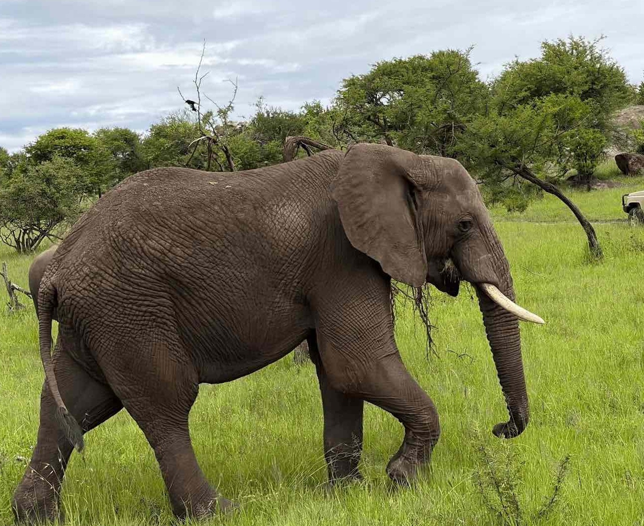
In lower zones, larger mammals such as elephants and buffalo may move through forest edges depending on seasonal availability of water and vegetation. These movements are part of broader East African ecosystem dynamics linked to surrounding conservation areas.
Mid-Altitude Faunal Reduction
As altitude increases:
- large mammals disappear due to oxygen limitations and lack of forage
- primate activity decreases significantly
- bird species become more specialized
Energy availability and temperature constraints strongly limit biodiversity density.
High-Altitude Specialization
Above moorland zones:
- only highly specialized bird and insect species persist
- survival depends on thermal adaptation and low oxygen tolerance
- food chain structures become extremely short and simplified
3. Human Environmental Adaptation Systems
Climbing the Rongai Route is not only a physical ascent but also a continuous process of human biological adaptation to environmental stress gradients.
Physiological Adaptation Layers
As climbers ascend, the human body undergoes structured adaptation phases:
Respiratory Adjustment Phase
- increased breathing rate to compensate for oxygen reduction
- deeper lung ventilation patterns
- higher oxygen extraction efficiency
Cardiovascular Adjustment Phase
- elevated heart rate at rest and during exertion
- improved circulation efficiency under hypoxic conditions
Hematological Adaptation Phase
- gradual increase in red blood cell production
- improved oxygen transport capacity over time
These adaptations are time-dependent, which is why slower ascent routes like Rongai improve summit success rates.
Energy System Adaptation
At altitude:
- carbohydrate utilization increases initially
- fat metabolism becomes more dominant over time
- caloric efficiency decreases despite reduced appetite
This creates an energy imbalance where demand exceeds perceived hunger, making nutritional discipline critical.
Thermoregulatory Adaptation
Human thermoregulation is challenged by:
- low atmospheric temperatures
- high wind exposure
- rapid heat loss through convection
The body compensates through:
- vasoconstriction (reducing heat loss)
- increased metabolic heat production
- behavioral adjustments (layering, movement pacing)
4. Psychological and Cognitive Environmental Interaction
Beyond physical adaptation, climbers experience measurable psychological responses to the Rongai environment.
Low-Stimulation Terrain Effect
Due to low population density and minimal visual complexity in upper zones:
- sensory input decreases
- perception of distance increases
- time perception becomes distorted
This creates what can be described as a quiet cognitive environment, where internal mental processing becomes more dominant than external stimuli.
Altitude-Related Cognitive Load
As oxygen decreases:
- decision-making speed slows slightly
- attention span becomes more effort-dependent
- fatigue perception increases disproportionately
These effects are gradual and often unnoticed until later stages of ascent.
Isolation Amplification Effect
Rongai’s low traffic levels produce a psychological condition where:
- social reinforcement is reduced
- internal motivation becomes primary driver
- perceived effort increases due to lack of external comparison
This can affect pacing consistency and energy management.
5. Integrated Mountain Systems Model (Final Synthesis)
The Rongai Route can be understood as a multi-layered environmental system composed of interacting biological, physical, and human response layers:
Layer 1: Physical Environment
- volcanic geology
- altitude-driven climate zones
- wind and hydrological systems
Layer 2: Biological Systems
- forest biodiversity networks
- moorland adaptation ecosystems
- alpine desert minimal survival systems
Layer 3: Human Adaptation Layer
- respiratory and cardiovascular response
- energy metabolism adjustments
- cognitive and psychological adaptation
Final System Interpretation
The Rongai Route is not simply a trekking path—it is a controlled environmental gradient system where:
- altitude governs all ecological transitions
- climate defines biological limits
- human physiology becomes a central adaptive variable
It is one of the clearest natural models on Earth for observing how life, climate, and geology interact within a single vertical system.
Are you ready to start planning?
You can proceed with booking by filling out the form below. Let’s make your adventure unforgettable!