Table of Contents
ToggleShira Route Kilimanjaro
The longest, most scenic, most remote & high success trekking expedition in africa
The Shira Route on Mount Kilimanjaro is one of the oldest and least frequently used trekking paths on the mountain, known for its dramatic landscapes, remote wilderness feel, and early exposure to high-altitude conditions. Stretching approximately 56 km (35 miles), it is often categorized among the shortest official routes, yet paradoxically it offers one of the most expansive and scenic traverses across Kilimanjaro’s western and southern slopes.
Historically, the Shira Route was the original western approach to Kilimanjaro before being refined into what is now the more commonly used Lemosho Route. In fact, Lemosho can be seen as a modernized evolution of Shira, adjusted specifically to improve acclimatization safety and reduce early altitude-related complications.
One of the defining characteristics of the Shira Route is its high starting elevation of approximately 3,600 meters (11,811 ft). Unlike other routes that begin in rainforest zones and allow gradual altitude gain, Shira begins directly on the alpine plateau. While this provides immediate access to spectacular views and open volcanic terrain, it also introduces a significant physiological challenge: climbers are exposed to reduced oxygen levels on the very first day.
This early exposure can be demanding for beginners, especially those without prior high-altitude experience. Starting at such elevation increases the risk of early altitude sickness symptoms such as headache, fatigue, nausea, and reduced appetite. For this reason, the Shira Route is generally recommended for climbers who are already reasonably acclimatized or who have experience trekking at altitude.
Despite this challenge, the route remains one of the most visually rewarding paths on Kilimanjaro, offering wide volcanic plains, shifting cloud systems, and uninterrupted panoramic views across the mountain’s western wilderness.
Shira Trail Climb Tips on Mount Kilimanjaro
The Shira Route requires a more deliberate and strategic approach compared to lower-starting routes. Because climbers begin at high altitude, the body has less time to adjust gradually, making pacing, hydration, and rest discipline absolutely essential.
One of the most important climbing strategies on this route is controlled progression, often summarized by guides as “pole pole” (slowly, slowly). This is not just a cultural phrase but a critical survival principle that determines oxygen efficiency and energy conservation at altitude.
Proper hydration is especially important on Shira due to dry air conditions at higher elevations. Climbers are encouraged to maintain consistent fluid intake throughout the day, even when thirst is not strong, because altitude reduces the body’s natural hydration signals.
Another key recommendation is pre-acclimatization before arrival in Tanzania, especially for climbers coming from sea-level countries. Spending time at moderate elevation prior to the expedition significantly improves success rates.
Mentally, Shira demands early adaptation to silence, isolation, and vast open landscapes. Unlike forested routes where visual stimulation is constant, Shira’s plateau environment can feel stark and exposed, requiring psychological adjustment to wide horizons and strong wind systems.
When properly managed, however, these conditions become part of the route’s unique appeal, offering one of the most expansive and cinematic trekking environments on Kilimanjaro.
Location
The Shira Route begins on the western side of Mount Kilimanjaro, accessed via a long drive from Moshi through lower agricultural zones and rainforest belts before reaching the Shira Plateau entry point.
Most expeditions start with a vehicle transfer from Moshi or Arusha, gradually ascending through changing ecological zones until reaching the high-altitude drop-off point near Shira Ridge. From this point, the trekking portion begins.
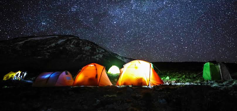
The western approach is significantly less crowded than the southern routes, offering a sense of remoteness and wilderness isolation from the very beginning. Climbers often report that this side of Kilimanjaro feels more untouched and expansive, with fewer visible trekking groups and greater exposure to open landscapes.
The Shira Plateau itself is one of the most remarkable geological formations on the mountain. It is a vast volcanic tableland formed by ancient lava flows, now eroded into rolling terrain, rocky ridges, and alpine grasslands. From this plateau, climbers can often see distant views of Mount Meru, as well as cloud formations moving across the Tanzanian plains below.
Height
The Shira Route ascends from its high-altitude starting point toward the summit of Mount Kilimanjaro at Uhuru Peak (5,895 meters / 19,341 feet), the highest point in Africa and one of the iconic summits of the Seven Summits challenge.
What makes the Shira Route unique is not just its endpoint, but the fact that climbers begin the journey already above 3,500 meters. This means a large portion of the climb takes place in alpine and high-altitude desert environments, where oxygen levels are significantly reduced compared to sea level.
This elevation profile creates both advantages and disadvantages. On one hand, climbers experience dramatic scenery immediately. On the other hand, the body is placed under altitude stress much earlier than on routes like Machame or Marangu, requiring careful acclimatization management throughout the entire trek.
The final ascent to Uhuru Peak is typically attempted from Barafu Camp, followed by a midnight summit push through Stella Point before reaching the crater rim and final summit plateau.
Duration
The Shira Route typically requires 6 to 7 days, although extended versions of 8 days are sometimes offered for improved acclimatization and higher summit success rates.
A 6-day itinerary is more physically demanding and compresses acclimatization windows, making it suitable only for experienced trekkers or those with strong altitude tolerance.
The 7-day version is widely considered the optimal balance between efficiency and safety, allowing climbers to adapt more gradually to altitude changes across the Shira Plateau, Lava Tower region, and southern circuit approach.
The 8-day variation significantly increases success probability by incorporating additional rest and acclimatization days, particularly in the mid-mountain zones where oxygen adaptation is most critical.
In general, every additional day spent on Kilimanjaro improves oxygen efficiency, reduces fatigue accumulation, and increases the probability of reaching the summit successfully.
Trail Conditions
The Shira Route is known for its highly diverse and rapidly changing terrain, which transitions through multiple ecological and geological zones in a relatively short distance.
The journey begins in open alpine environments immediately after the plateau entry, bypassing lower rainforest zones entirely. This creates a striking contrast compared to other Kilimanjaro routes.
The main terrain types include:
- Expansive grassy moorlands with low vegetation
- Volcanic rock formations shaped by ancient lava flows
- Wide open plateaus with minimal tree cover
- High-altitude desert landscapes with thin air and strong winds
- Rocky ascents leading toward Lava Tower and southern circuit junctions
Temperature variations are significant throughout the day. Mornings may be cold and windy, while midday sun exposure can feel intense due to thinner atmosphere and reduced UV filtering.
At higher elevations, especially above 4,000 meters, oxygen levels decrease noticeably, and trekking pace naturally slows. Climbers often experience a sense of physical heaviness and reduced endurance capacity, even at moderate walking speeds.
Despite these challenges, the Shira Route is widely regarded as one of the most visually impressive trekking experiences on Kilimanjaro due to its panoramic openness and dramatic volcanic landscapes.
Climbing Kilimanjaro via Shira Route
The expedition along the Shira Route begins with a long scenic drive from Moshi town or Arusha, passing through cultivated farmland, village settlements, and dense rainforest belts before ascending toward the western slopes of Kilimanjaro.
As the vehicle climbs higher, vegetation gradually changes from tropical forest to heathland, and eventually transitions into the stark volcanic environment of the Shira Plateau. This gradual visual shift prepares climbers psychologically for the alpine conditions ahead.
The trek officially begins at Shira Ridge, one of the highest accessible starting points on the mountain. From here, climbers traverse the Shira Plateau from west to east, moving across expansive volcanic terrain that feels almost lunar in nature.
One of the defining features of this route is its connection to the Southern Circuit, which passes beneath the famous Southern Ice Fields of Kilimanjaro. This section offers some of the most dramatic glacier views on the entire mountain before joining the main ascent route toward Barafu Camp.
The final summit approach is shared with other major routes, where climbers ascend at night toward Stella Point and ultimately reach Uhuru Peak at sunrise.
The descent typically follows the Mweka Route, one of the most commonly used and direct descent paths on the mountain. This route provides a rapid return through rainforest zones, allowing climbers to experience yet another ecological transformation on the way down.
Shira Route Itineraries (6, 7, and 8 Days)
The Shira Route can be structured in multiple itinerary formats depending on acclimatization strategy and operator design.
- 6-day itinerary: Fast-paced, physically demanding, limited acclimatization
- 7-day itinerary: Standard recommended version with balanced altitude adaptation
- 8-day itinerary: Extended version with improved summit success rates
Among trekking operators, the 7-day itinerary is the most commonly offered because it provides a strong balance between cost, safety, and performance.
At Tranquil Kilimanjaro and other professional expedition companies, the 7-day Shira Route is typically considered the standard package, while extended versions are available upon request for climbers seeking maximum acclimatization support.
Shira Route Map
The Shira Route map closely resembles the Lemosho Route, but with a key distinction: it begins at a significantly higher altitude on the Shira Plateau rather than at the rainforest base.
This difference has a major impact on acclimatization dynamics. While the route offers stunning scenery and a shorter initial approach, the high starting elevation can reduce early-stage oxygen adaptation for climbers without prior altitude experience.
The route spans approximately 56 km over 6 to 8 days, traversing volcanic plateaus, alpine deserts, and high mountain circuits before joining the southern summit approach.
Due to its altitude profile, the Shira Route is less frequently chosen compared to Lemosho or Machame, and is generally recommended for trekkers who are already confident in high-altitude trekking environments.
Despite its lower popularity, it remains one of the most visually spectacular and geologically unique trekking routes on Mount Kilimanjaro.
Are you ready to start planning?
You can proceed with booking by filling out the form below. Let’s make your adventure unforgettable!